
Drone Technologies for Assessing Tree Health Conditions
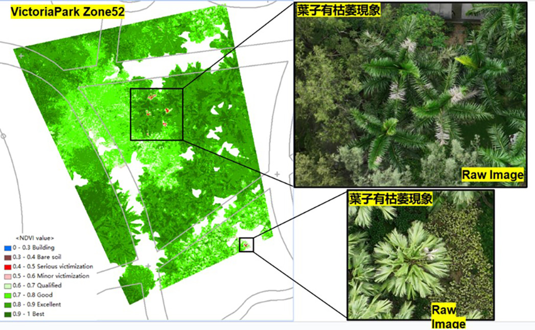
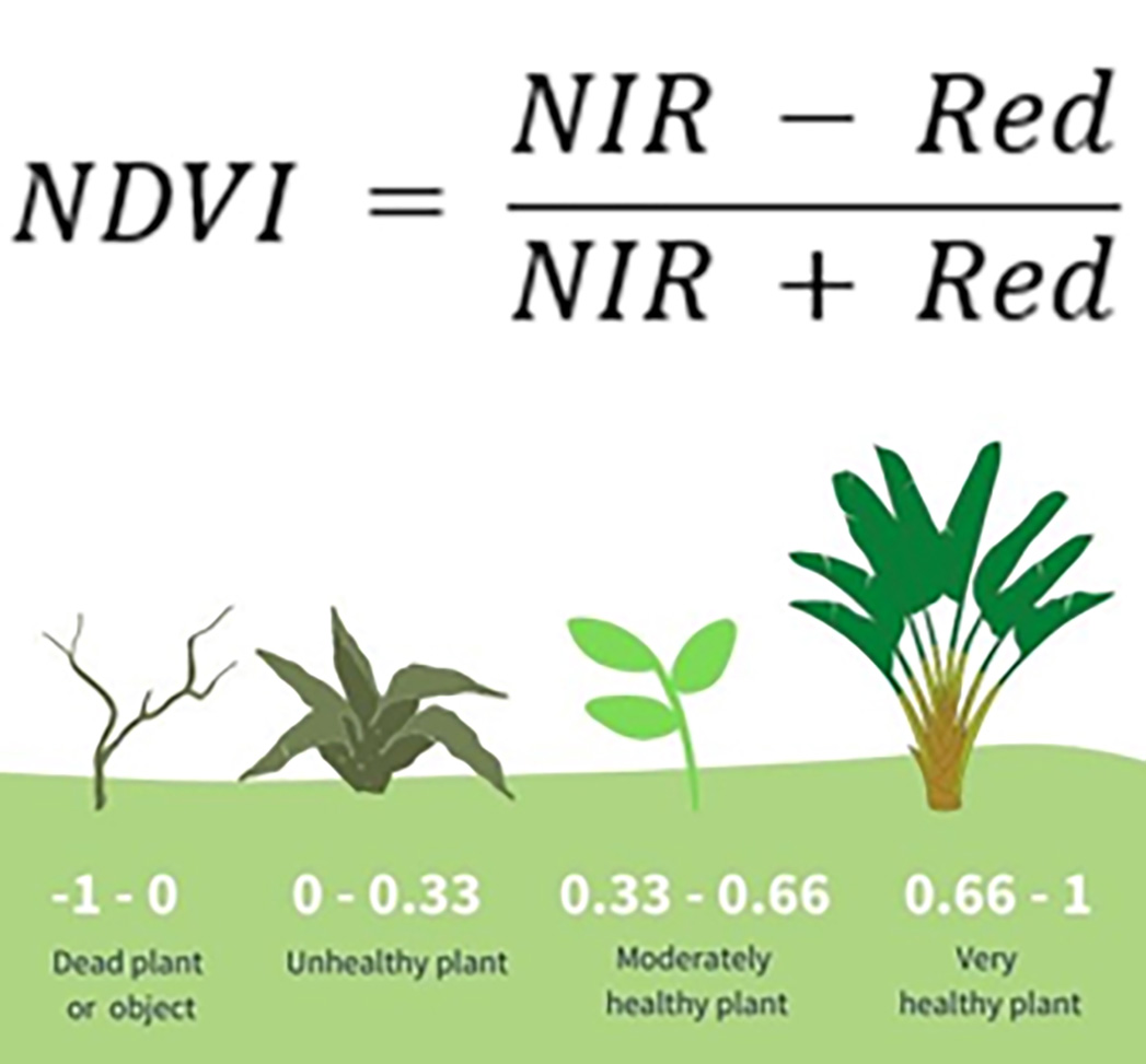
This project aims to utilize drone technology and the Normalized Difference Vegetation Index (NDVI) for conducting aerial tree risk assessments in Hong Kong Victoria Park and the Hong Kong Zoological and Botanical Garden. We assessed the condition of approximately 170 trees across diverse species, implementing advanced solutions to identify potential risks and monitor tree health.
Ambit Geospatial Solution and third parties collect personal information as specified in the privacy policy and use cookies or similar technologies for technical purposes and, with your consent, for experience, measurement and marketing (personalized ads) as specified in the cookie policy.
You can freely give, deny, or withdraw your consent at any time by accessing the preferences panel. Denying consent may make related features unavailable.
Use the “Accept” button to consent. Use the “Reject” button to continue without accepting.