
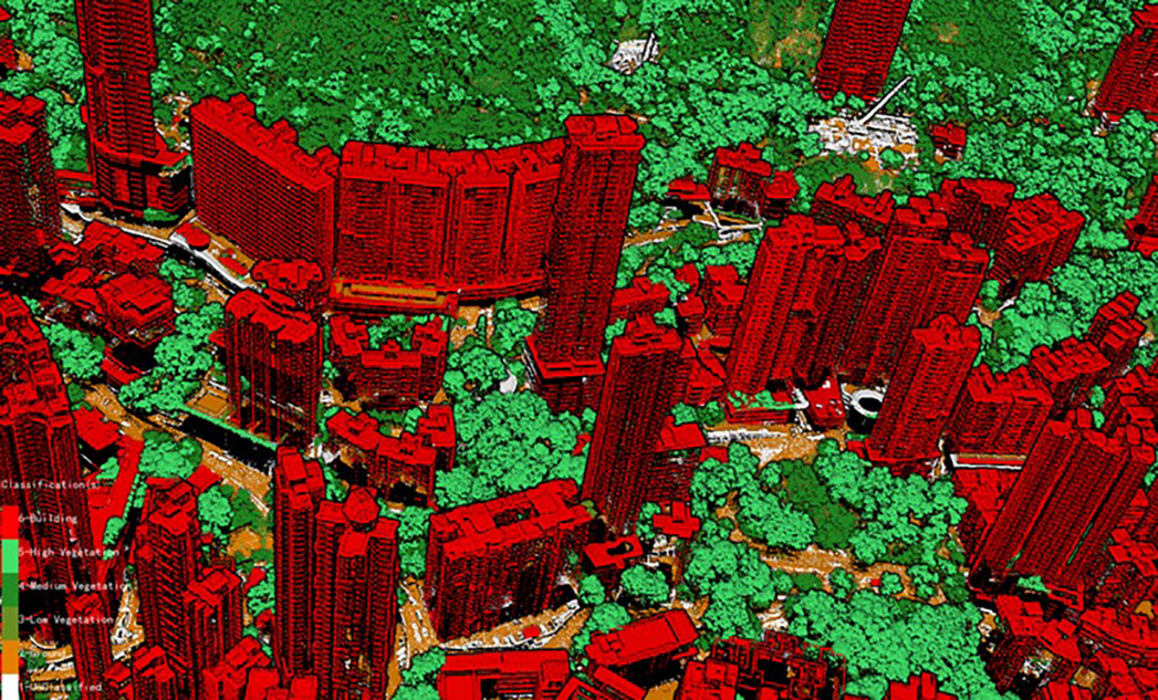
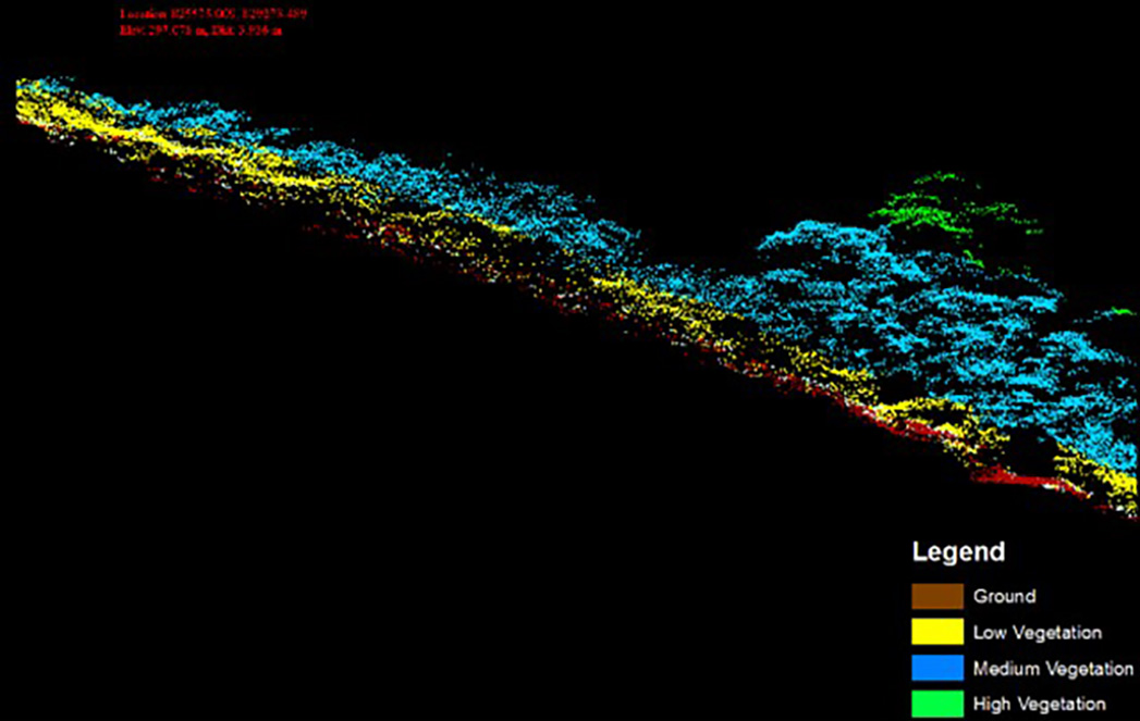
Territory-wide Airborne Light Detection and Ranging (LiDAR) Survey(Project Area: 1,115 km2)
The 2020 Territory-wide Airborne LiDAR project provided a significance to the Hong Kong Geospatial industry, the final dataset was used by all Hong Kong government departments such as Lands Department and Planning Department
Ambit Geospatial Solution and third parties collect personal information as specified in the privacy policy and use cookies or similar technologies for technical purposes and, with your consent, for experience, measurement and marketing (personalized ads) as specified in the cookie policy.
You can freely give, deny, or withdraw your consent at any time by accessing the preferences panel. Denying consent may make related features unavailable.
Use the “Accept” button to consent. Use the “Reject” button to continue without accepting.