The GET3D Cluster Suite is a large-scale photogrammetric 3D modeling software developed by Get3D. It enables quick and accurate aerial triangulation and reconstruction, supporting various data sources such as aerial photos, close-range images, LiDAR point clouds, and videos.
Choose GET3D Cluster or GET3D farm based on the amount of data, and reconstruct a real-life 3D model; Using ModelFun modeling and Grid Master to reduce data volume; For emergency situations, the Eagle-eye system can be used for real-time and efficient 3D reconstruction, with a wide range of applications; All data can be shared online through Cloud Earth publishing.
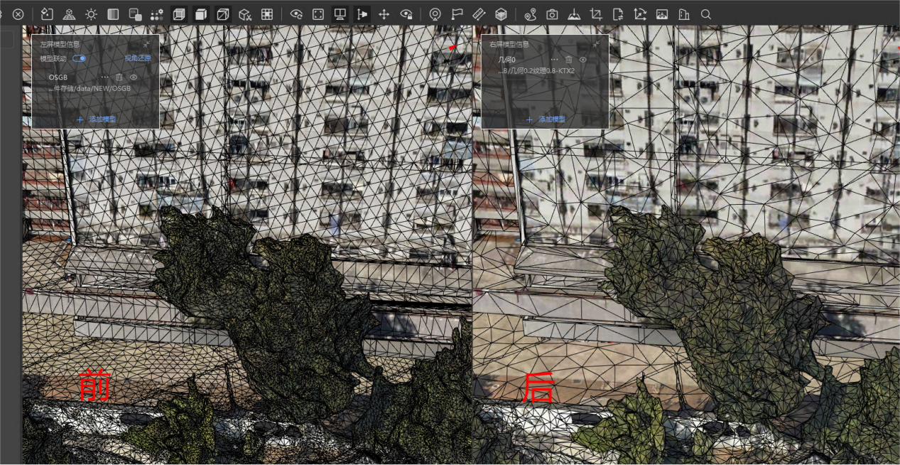
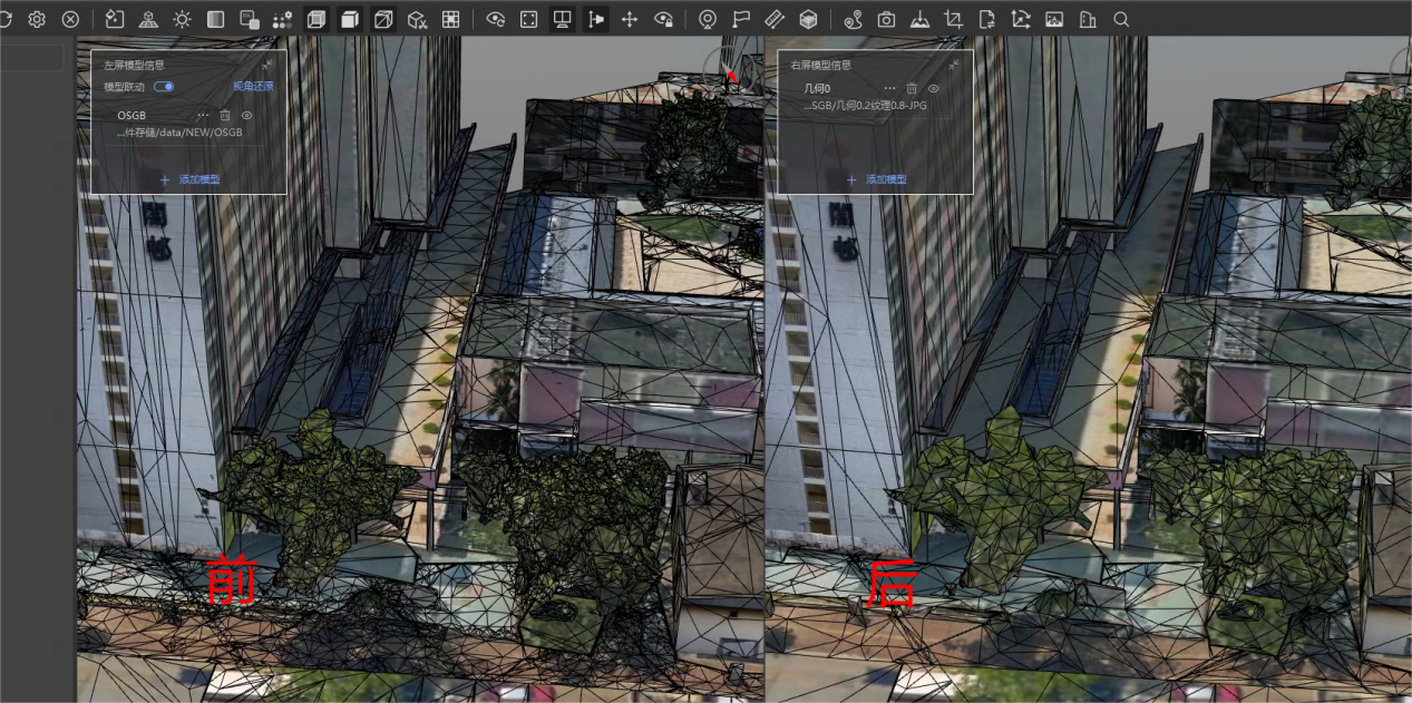
Data lightweighting (Grid Master): Grid Master can achieve data reduction by reducing the number of triangular meshes in the 3D model, while maintaining the quality of the model.