Skyline Software Systems, Inc. is a leading provider of 3D earth visualization software and services. The company offers a comprehensive platform of applications, tools and services that enable the creation and dissemination of interactive, photo-realistic 3D environments. The SkylineGlobe software suite sets the standard for 3D desktop and web-based applications, enabling an enterprise to build, edit, navigate, query, and analyze realistic 3D environments, and rapidly and efficiently distribute them to users.
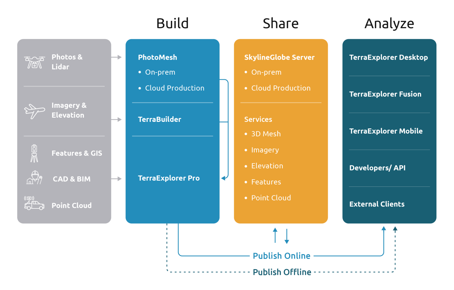
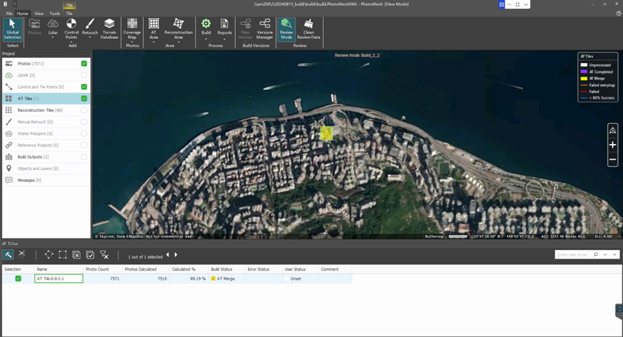
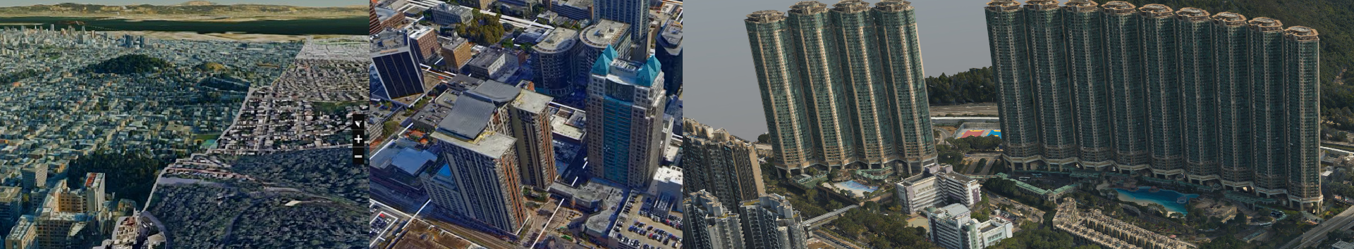
PhotoMesh uses advanced photogrammetry and computer vision to create detailed 3D meshes, orthophotos, elevation models, and point clouds from various photo formats. It efficiently handles large projects with hundreds of thousands of photos using tiling mechanisms and can leverage computer clusters or cloud computing to speed up processing by running projects on multiple machines simultaneously.
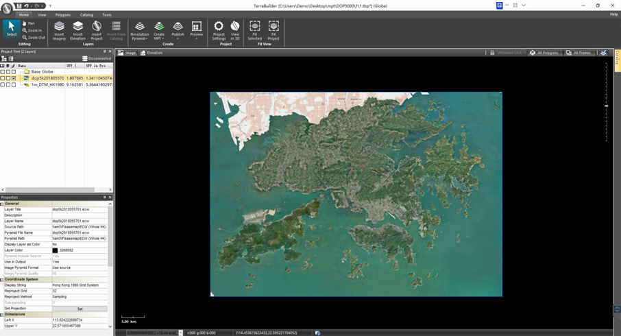
TerraBuilder provides professional-grade tools for manipulating and merging aerial photos, satellite images, and digital elevation models of different sizes and resolutions. The resulting photo-realistic, geographically accurate terrain database can be made available to local TerraExplorer clients or published directly from TerraBuilder to SkylineGlobe Server for serving to remote TerraExplorer and WMS/WMTS clients.
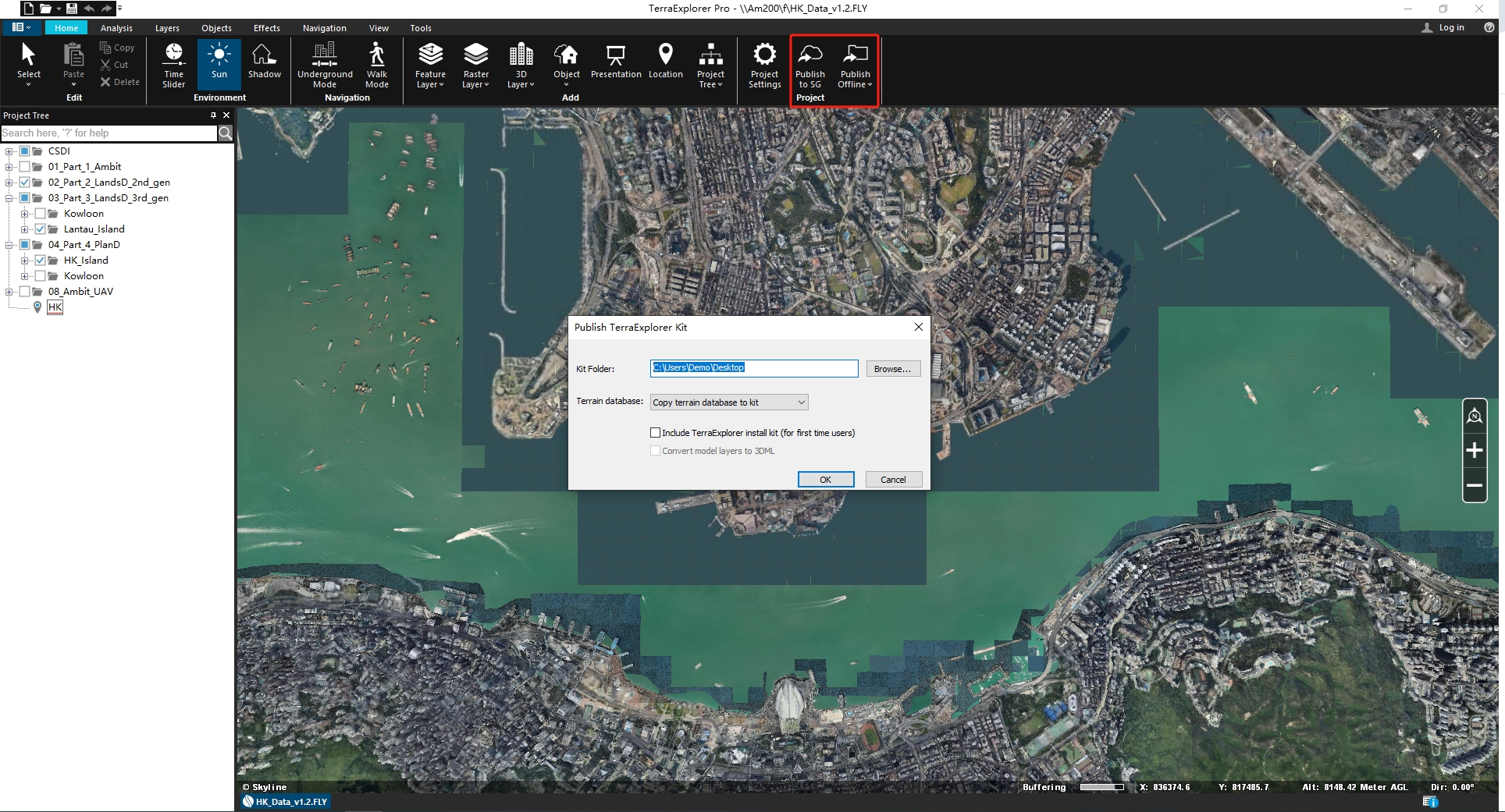
TerraExplorer Pro is the most advanced version in the TerraExplorer Desktop series. In the "Build" section, it provides publishing capabilities (Online & Offline), conversion tools, and optimization of model files for improved display performance.
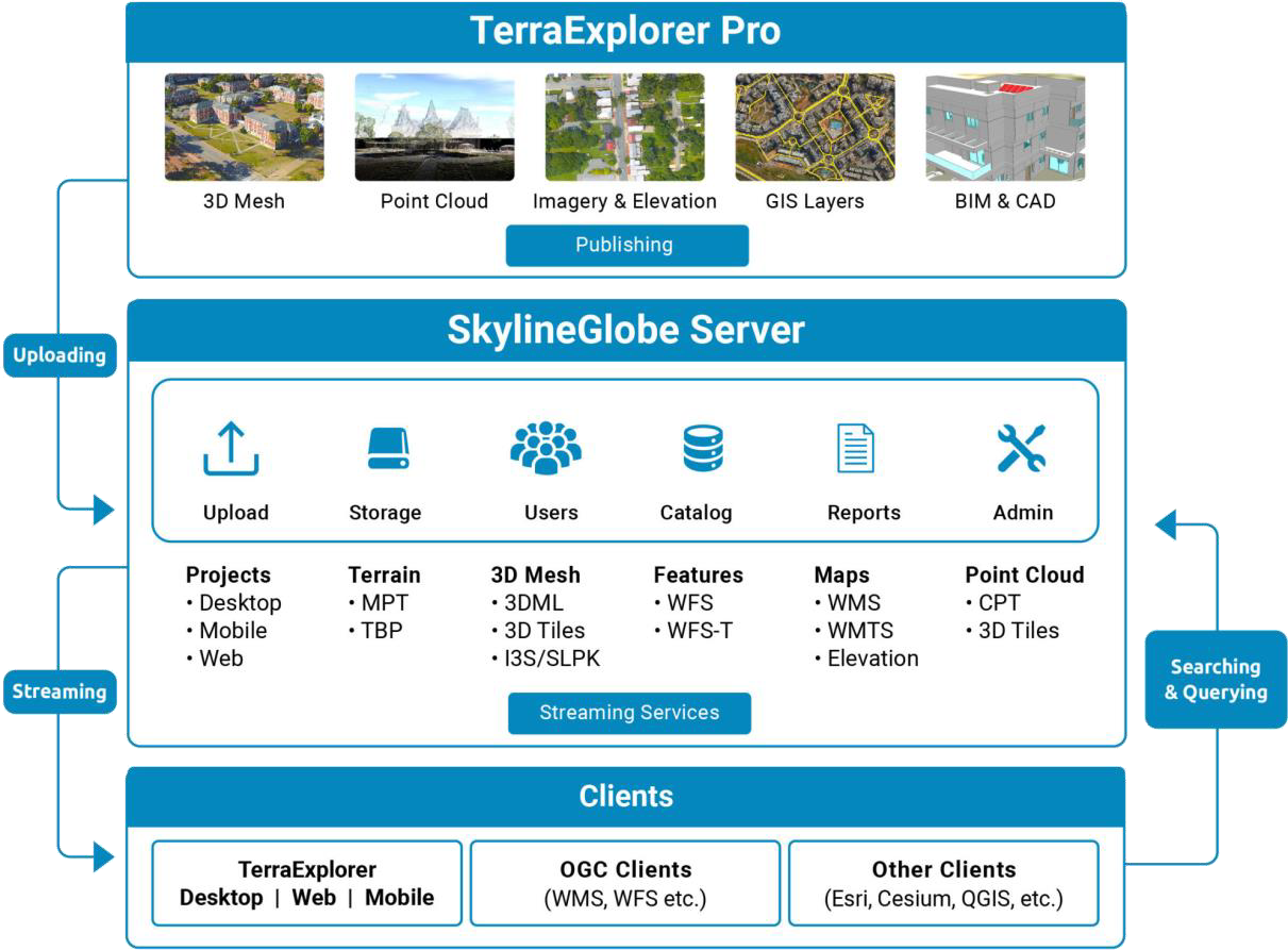
The SkylineGlobe Server private cloud solution provides a comprehensive set of web services for publishing, storing, managing and streaming 2D and 3D geospatial content. All your GIS layer types are supported: 3D mesh , imagery, elevation, feature and point cloud. SkylineGlobe Server makes it easy for you to share your data by converting and exposing your content in multiple formats.
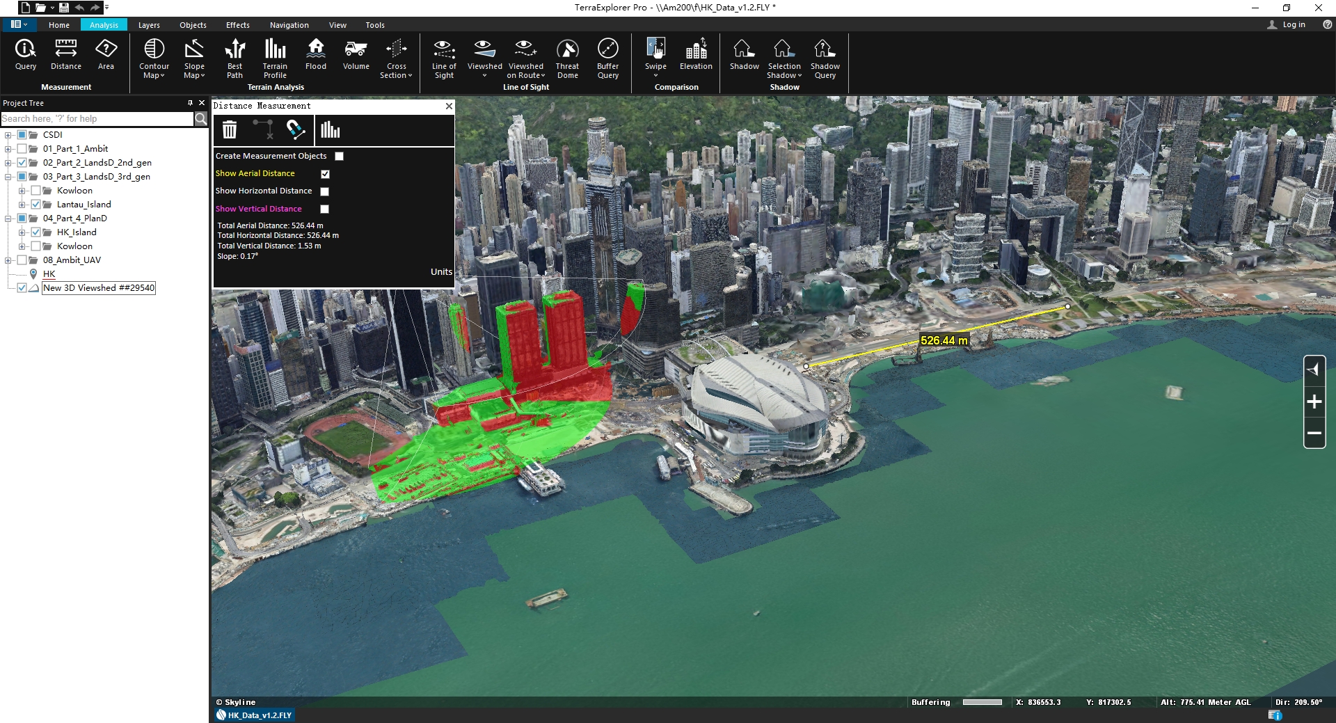
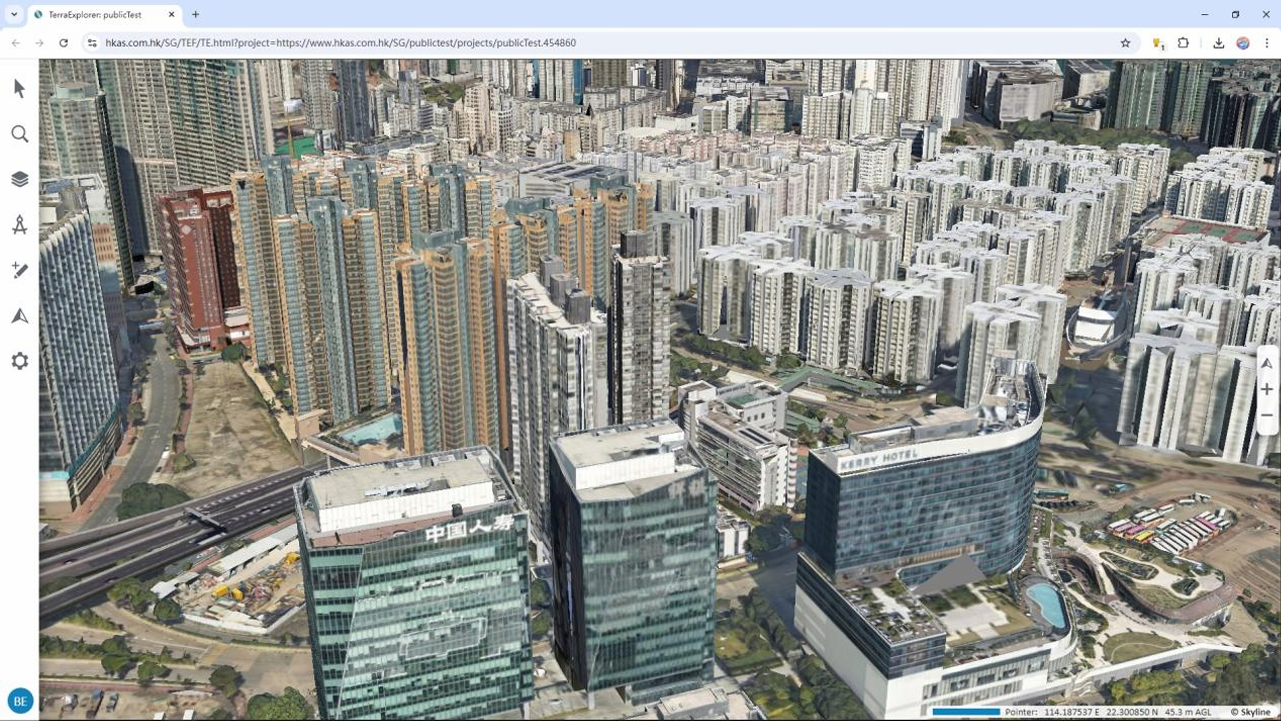
TerraExplorer Desktop is a cutting-edge 3D GIS desktop viewer and creator that provides powerful tools and a high resolution 3D environment in which to view, query, analyze and present geospatial data. With TerraExplorer’s robust and extensive capabilities and ever-increasing interoperability, stunningly realistic 3D visualizations can be created by overlaying the terrain with unlimited data layers, 3D models, virtual objects and more.
Experience TerraExplorer’s Mixed Reality for an immersive 3D environment. It transforms your 3D view into a lifelike hologram, viewable on four headsets simultaneously for seamless collaboration. With head tracking and intuitive controls, users can navigate, annotate, measure distances, and interact with holographic models using gestures, enhancing tactical planning and strategic execution.
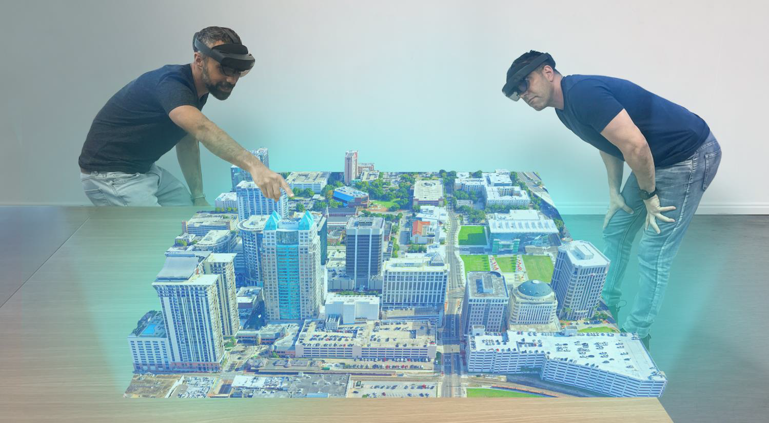
Photo Inspector
Stay competitive by integrating Skyline’s advanced technology into your inspection services. PhotoMesh automates inspections using drone-captured images, converting them into high-resolution, textured 3D mesh models with sub-millimeter accuracy. These models can be viewed and analyzed in TerraExplorer's "Photo Inspector" feature, enabling safe and efficient inspections.
Web-based 3D geospatial viewer for exploring, analyzing, and editing high-resolution, stunningly realistic 3D content right in your web browser with no download or installation required. TerraExplorer Fusion enables you to view layers and objects from SkylineGlobe Server and other GIS data servers, perform measurements and analysis operations, and customize web applications tailored to any customer needs.
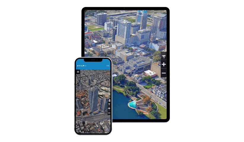
TerraExplorer for Mobile is a powerful 3D GIS viewer for Android & Apple iOS devices based on TerraExplorer for Web, that offers the functionality of the web app in a mobile-optimized GUI. TerraExplorer for Mobile can display most of your spatial databases including 3D city layers and feature layers, and it provides powerful tools to query, analyze and present your data on the go.
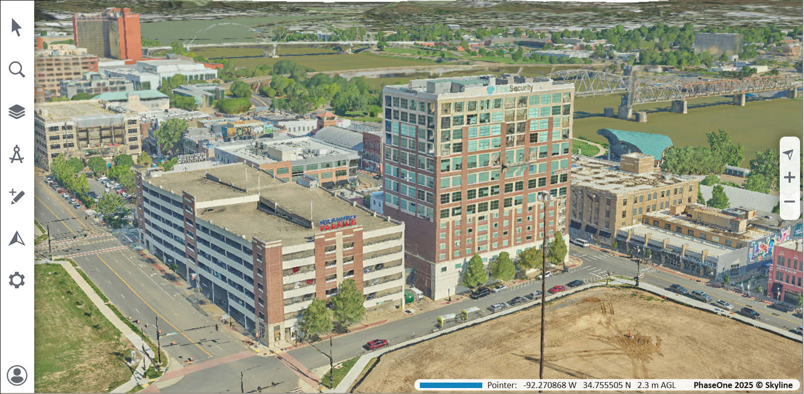
With PhotoMesh’s ability to process native Phase One Intelligent Image Quality (IIQ) images, users can seamlessly generate engineering-grade 3D models and ultra-high-resolution true-orthophotos. This ensures a streamlined workflow and maximizes the accuracy and efficiency of 3D city modeling. In Little Rock, Arkansas, this challenge is being tackled head-on with Skyline Software System’s Photomesh and Phase One’s P880i Aerial Camera System, delivering detailed 3D mesh models at an incredible 1.5 cm resolution.