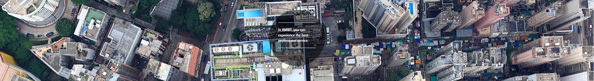
AMBIT is a technology company that focus on city-wided “Big Data” acquisition and analysis by using our developed aerial robotic machine (UAV/UAS/Drone/Aerial Camera) and geospatial software. We focus solely on enterprise application including. environmental, agricultural, land surveying, planning and construction engineering fields. We targets as one of the best independent geospatial consultant company in the world; having developed a tradition of excellence in providing professional GIS services to government and a broad range of industries internationally. Throughout these years our GIS team had worked together with various engineering expertise using innovative geospatial technologies to resolve project challenges. Our staffs have built decades of success in multi-disciplinary GIS services including engineering, environment, planning as well as water applications. We are total geospatial solution provider supplying both data acquisition hardware and geospatial analysis software as well as services to our client. We specialize in 3D geospatial system (3D GIS), terrestrial and aerial photogrammetry mappings and manufacturing of professional aerial mapping drone and camera.
Surveying & Mapping
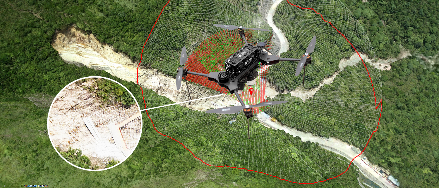
Oblique photogrammetry is a new technology in the field of photogrammetry, and it is a hot research topic in the world. Oblique Photogrammetry intensive multi-view image matching algorithm is more complicated than the current digital image matching. Because it contains more data sources, in particular the multi-view image, so the matching process needs to consider matching time, speed, and reliability issues. So Normally Generate 3D model by using Oblique photogrammetry is expensive .Our company provide a first affordable total solution based on Oblique Photogrammetry, from data capture to 3D model generation
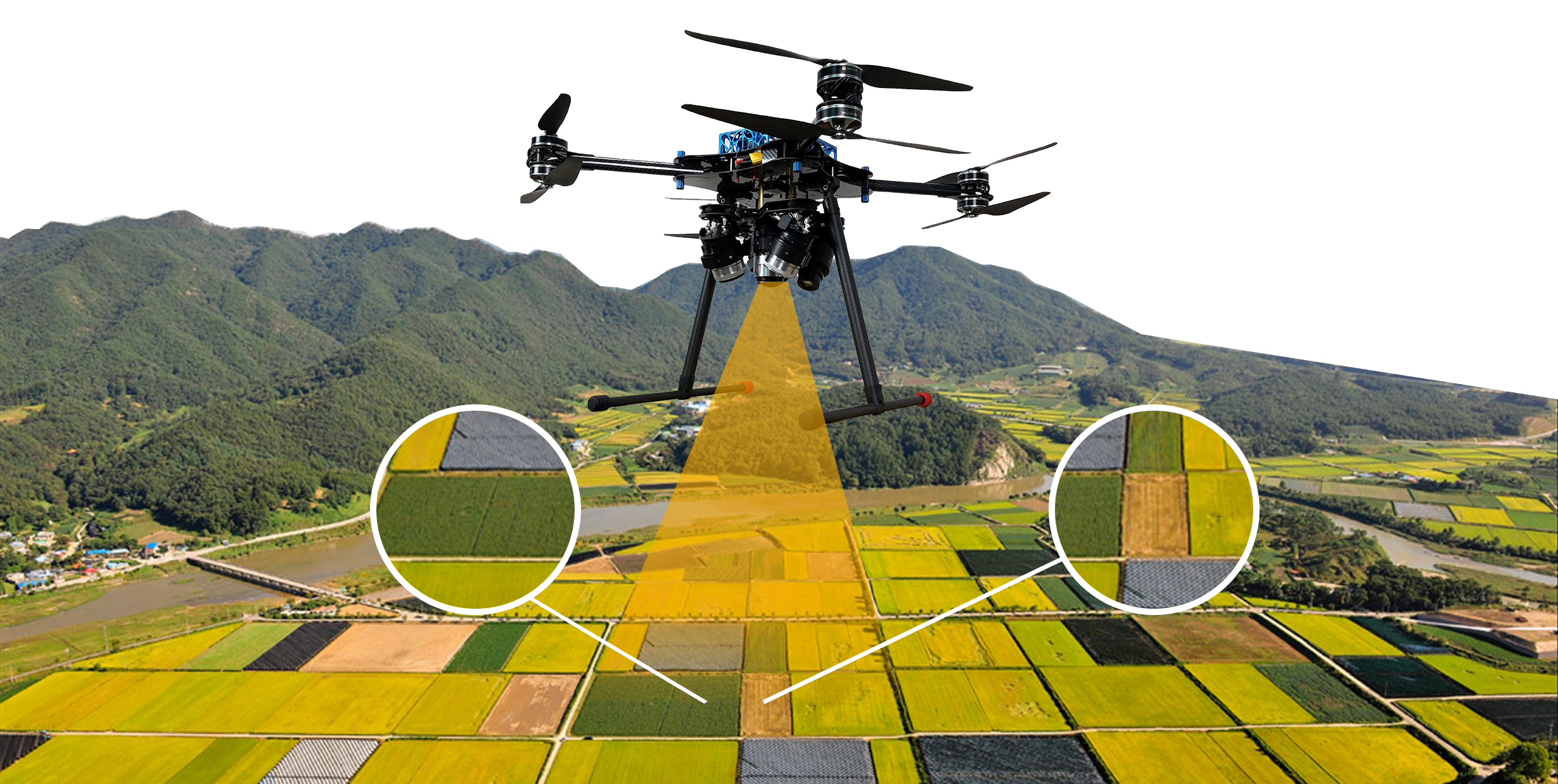
Precision Agriculture
For generations farmers have walked their fields investigating crops manually for signs of stress or disease. This traditional, labor intensive method is time consuming and can be difficult when crop canopies thicken. With Eagle-Eye ,farmers are able to evaluate their crops at scale while simultaneously creating crop maps that help them manage crops and time better.
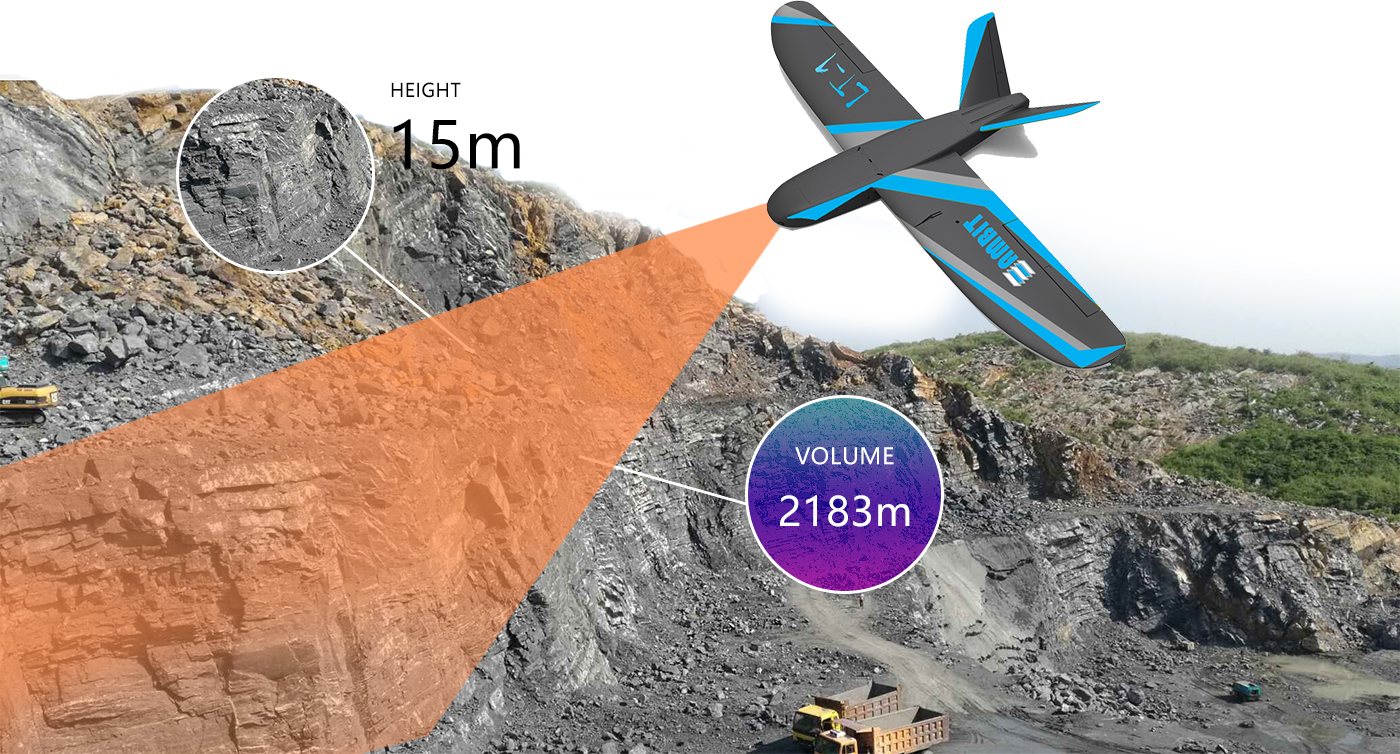
Mining & Aggregates
Oblique photogrammetry is an innovative technology gaining traction in mining and aggregates, leveraging advanced multi-view image matching to generate highly detailed and accurate 3D models. This process involves handling large data sets from multiple perspectives, requiring careful consideration of matching time, speed, and reliability. Traditionally, creating 3D models with oblique photogrammetry has been costly and complex. However, our company provides an affordable, end-to-end solution, covering everything from data capture to the generation of precise 3D models. This enables efficient planning, monitoring, and management of mining and aggregate operations with greater accuracy and cost-effectiveness.
Process Power & Utilities
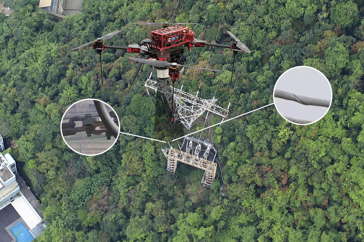
An unmanned aerial vehicle (UAV) is an advanced, autonomous, unmanned aerial vehicle. UAV transmission line inspection system is a complex integrated system of aviation, electricity transmission, electricity, meteorology, telemetry and remote sensing, communication, geographic information (GIS), image recognition and information processing. It involves flight control technology, airframe stability control technology, Data link communications technology, modern navigation technology, airborne telemetry and remote sensing technology, fast focus camera technology and fault diagnosis and other top-notch technology. Modern UAVs have the capability of high altitude, long distance, fast operation and self-operation. They can cross the high mountains and rivers to conduct fast patrolling of power transmission lines, such as towers, brackets, wires, insulators, shockproof hammers, Suspension clips and other full spectrum of fast video and fault monitoring. .
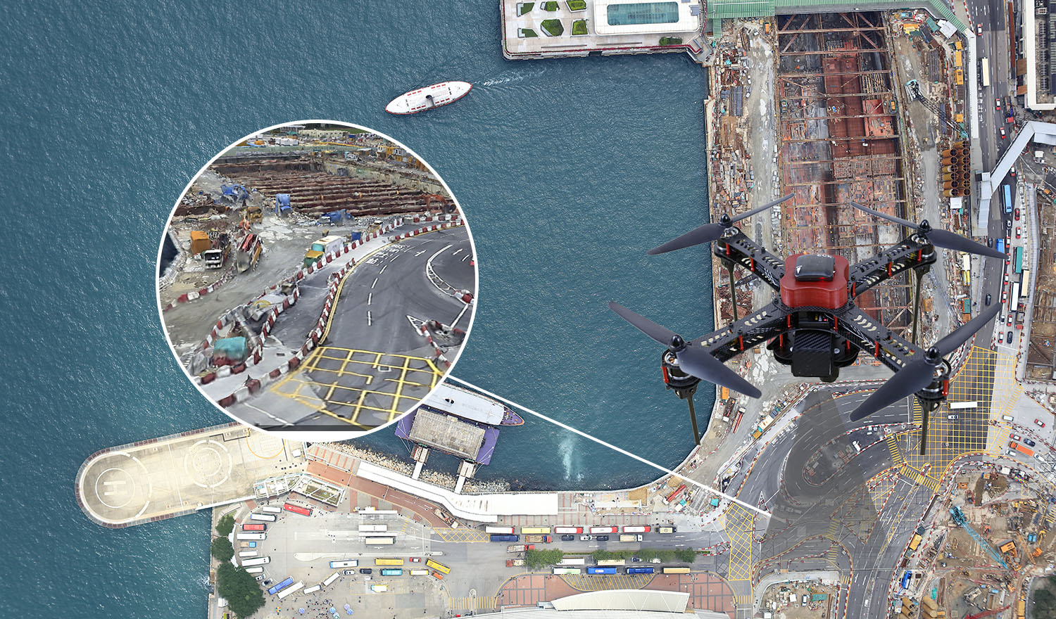
Civil Infrastructure
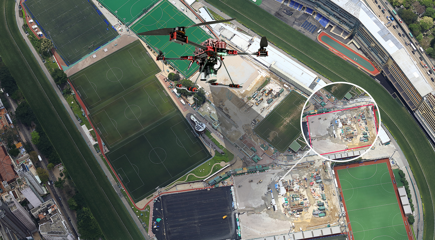
With the great development of urban construction, much of our infrastructure are under the higher pressure to ensure the city's high efficiency work. Therefore, How to plan, design, manage and maintain our infrastructure have become an important problem for managers. Our UAV survey solutions could contribute to those situations of infrastructure. The aerial images captured by UAV could easy transform to accurate 2D orthophotos, maps and 3D virtual models that can be explored by computer software. 3D models could help managers to find the defects of the present infrastructure and simulate the tolerance of infrastructure in the crisis situation, it also can do visual inspection and metric measurement of UBW. Those data allows experts to evaluate the needs of the city system and help them work in more effectively way. Our UAVs can also equip with other kind of cameras such as Thermal Sensors, Multi Spectrum Sensors for Engineering or Security Application and check the hidden danger of our infrastructure.
Law Enforcement,Emergency Response & Search and Rescue
Many technological breakthroughs in recent years have emerged in places areas where it was least expected. Unmanned aerial systems, for example, have transitioned from highly defense-focused applications to a multitude of commercial use cases that transcend industries.
But what makes UAS, more commonly referred to as drones, fit for emergency response? As previously discussed, aerial views are critically helpful in large-scale disaster zones.
Drones, designed to be agile, fast and robust, empower response teams with a substantial upper hand without costing as much as manned flight operations. Because many are autonomously flown, drones can access hard-to-reach areas and perform data-gathering tasks that are otherwise unsafe or impossible for humans.
Our company provide a first affordable total solution based on aerial solutions.
Ultra High Resolution 3D Mesh Model
Using UAV photography, our technology generates an ultra-high-resolution 3D mesh model of Jumbo, ensuring remarkable detail and accuracy. This process captures complex structures, offering precise orthomosaics and 3D reconstructions.
Perfect for professionals seeking advanced mapping and modeling solutions, this model provides unparalleled clarity and is ideal for large-scale projects where precision matters.