Whether for corridor mapping, infrastructure inspection, forestry, or urban planning, our helicopter surveys ensure superior maneuverability and efficiency, delivering reliable insights for critical decision-making.
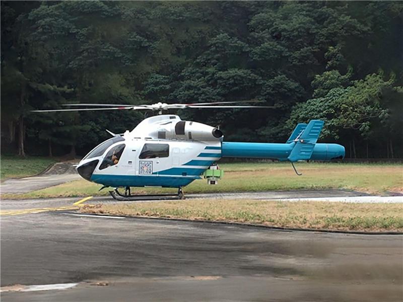
MD902 Explorer
The MD902 helicopter is an ideal platform for aerial survey missions due to its agility, stability, and advanced technology. Its twin-engine design and NOTAR (No Tail Rotor) system provide a quieter, safer, and more stable flight, making it well suited for low-altitude data collection. With a spacious cabin and high payload capacity, the MD902 can accommodate a variety of survey equipment, such as LiDAR, high-resolution cameras, and multispectral sensors. The MD902 enhances aerial surveys in applications like infrastructure inspection, urban mapping, and environmental monitoring.
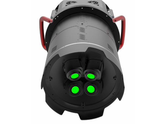
SWDC-4
The SWDC-4 is a high-performance multi-lens aerial camera system designed for efficient large-area mapping and photogrammetry. Equipped with four synchronized lenses, it captures high-resolution images with a wide field of view, enabling faster data collection over vast terrains. The SWDC-4 is ideal for applications like urban planning, land use monitoring, and infrastructure development, offering precise and detailed imagery for 3D modeling and orthophoto generation. Its robust design ensures reliable performance under demanding survey conditions, making it a versatile choice for aerial mapping projects.
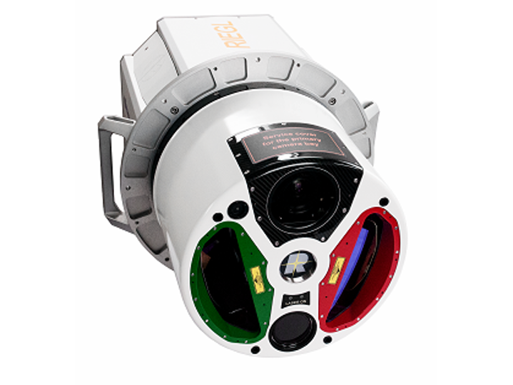
RIEGL VQ-1560i
The RIEGL VQ-1560i is a dual-channel airborne LiDAR system designed for highly efficient data acquisition over large areas. With its advanced laser scanning technology, it captures high-density point clouds, offering exceptional accuracy and detail for terrain mapping, forestry, and infrastructure surveys. The system's dual laser channels enable simultaneous data capture from two different angles, enhancing coverage and reducing survey time. Its integrated GNSS/IMU ensures precise georeferencing, making the VQ-1560i ideal for applications like corridor mapping, floodplain analysis, and urban modeling, delivering reliable, high-quality LiDAR data.
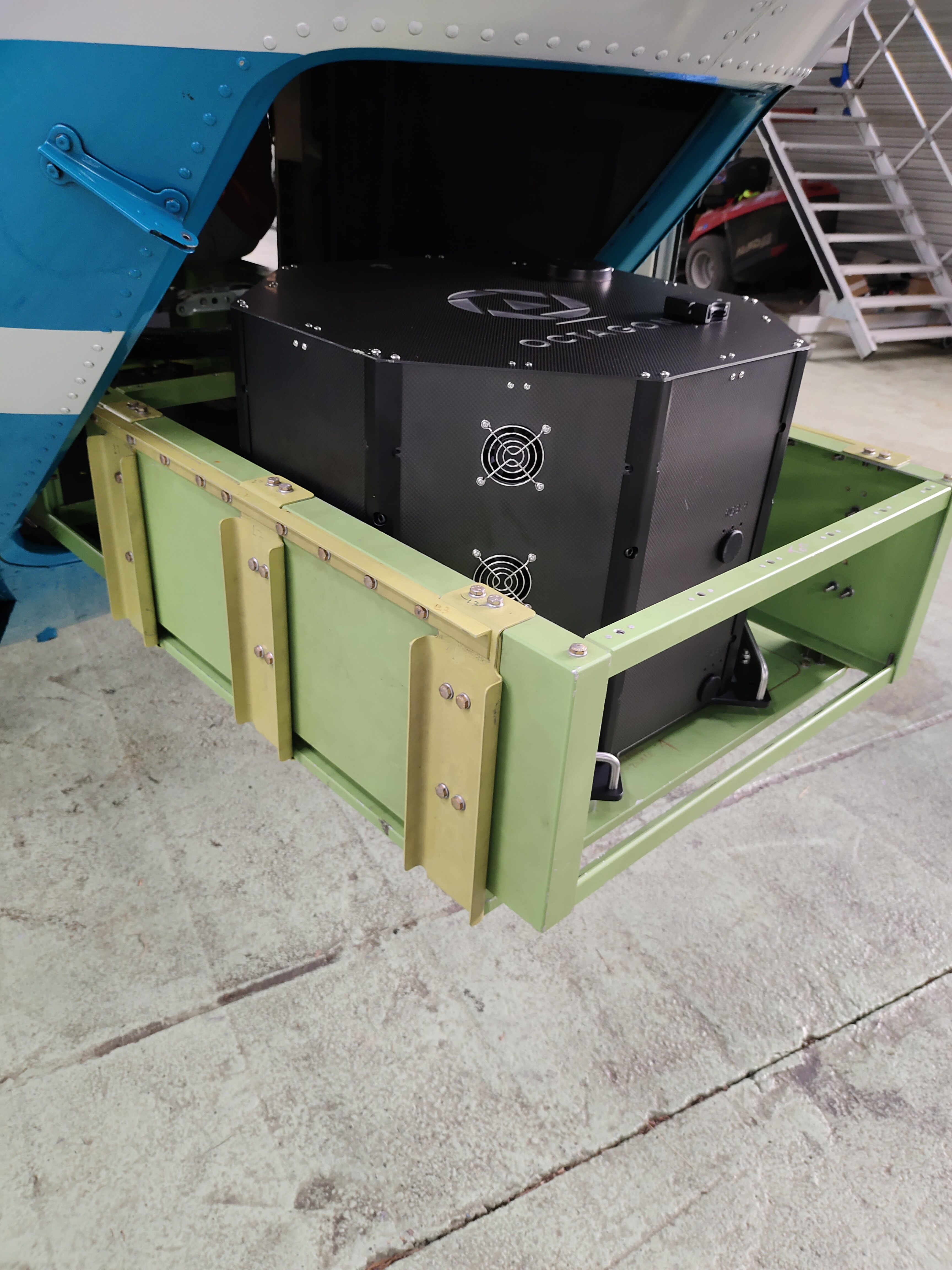
Octagon X
Octagon is the Xth generation aerial photogrammetry system independently developed and designed by Ambit Geospatial Solutions. The system consists of two main components: an oblique photography camera and a ground station. The body of the system is made from aerospace-grade metal and carbon fiber composite materials, providing high structural strength while maintaining a lightweight design.
The oblique photography camera is equipped with nine high-resolution multi-angle lenses, with both the ortho camera and the oblique camera featuring over 100 million pixels in medium format. It can simultaneously capture real images with spatial information from vertical and multiple oblique angles. Each camera is equipped with an independent POS system, with a positioning accuracy of up to 1 cm.
This system allows real-time monitoring of each camera's shooting status through the ground station. The data interface uses the camera's built-in SD card for storage, with a maximum transmission speed of up to 140 MB/s. The storage capacity can be expanded to a maximum of 2 TB, enabling the capture of ultra-high-definition photos with sufficiently high coverage during high-speed flights.
Specification of Aerial Camera