
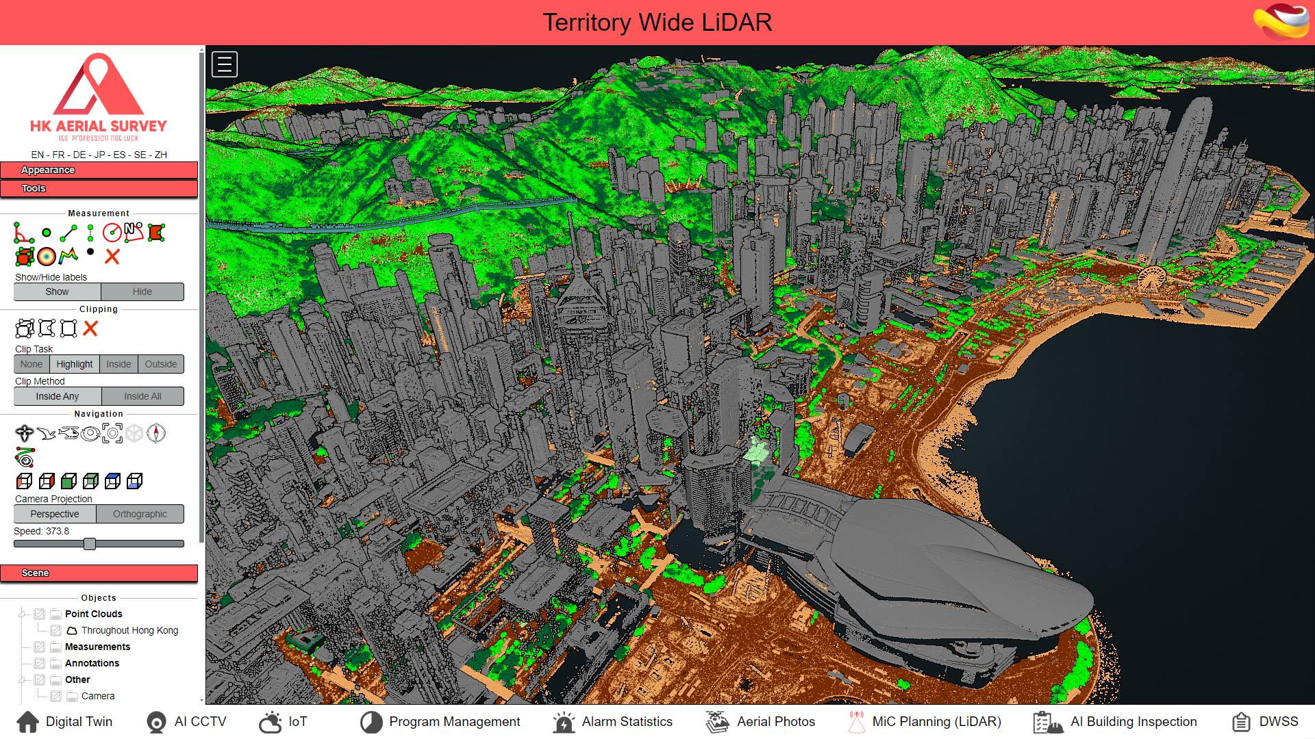
Integrated Hong Kong-Wide LiDAR Data
The MiC Planning (LiDAR) module is a powerful online point cloud viewer specifically designed for construction and infrastructure planning in Hong Kong. Key features include:

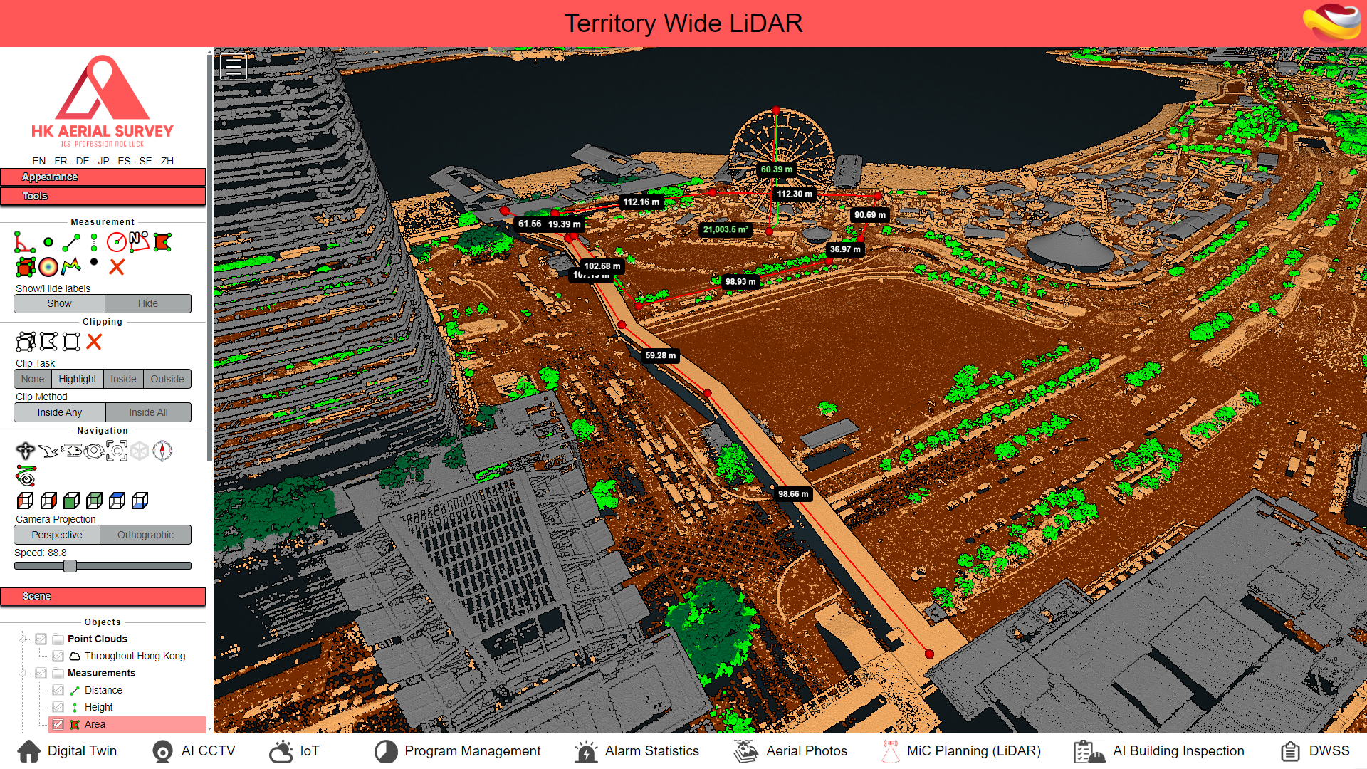
Enhancing Project Accuracy with Advanced Measurement Tools
The MiC Planning (LiDAR) module empowers construction and infrastructure professionals with comprehensive measurement tools tailored for precise data analysis. Users can measure distances, areas, and angles directly within the point cloud viewer, streamlining the planning and design process. These tools enable accurate site assessments, minimizing errors and enhancing project feasibility studies. By integrating high-resolution LiDAR data with intuitive measurement capabilities, the platform ensures engineers and planners can make informed decisions quickly, improving project efficiency across all construction stages.
Seamless Access to Territory-Wide LiDAR Data
The MiC Planning (LiDAR) module provides seamless access to Hong Kong's 2020 LiDAR dataset, covering the entire region with high-precision point cloud data. This integration allows planners, engineers, and surveyors to analyze terrain, visualize site conditions, and generate profiles effortlessly. Combined with powerful analysis tools for elevation, density, and cross-sections, the platform serves as a one-stop solution for comprehensive site evaluation. With smooth visualization and responsive performance, users can handle large-scale projects confidently and efficiently within a single system.
MiC Planning(LiDAR) of 3D TOMATO
The MiC Planning (LiDAR) module is a powerful online point cloud viewer specifically designed for construction and infrastructure planning in Hong Kong

Ambit Geospatial Solution and third parties collect personal information as specified in the privacy policy and use cookies or similar technologies for technical purposes and, with your consent, for experience, measurement and marketing (personalized ads) as specified in the cookie policy.
You can freely give, deny, or withdraw your consent at any time by accessing the preferences panel. Denying consent may make related features unavailable.
Use the “Accept” button to consent. Use the “Reject” button to continue without accepting.