
Integrated Aerial Imagery Platform for Project Tracking
The Aerial Photos module enables site managers to view and manage a large collection of drone-captured photos and videos via a web browser. Its key features include:
Enhancing Site Oversight with Geospatial Intelligence
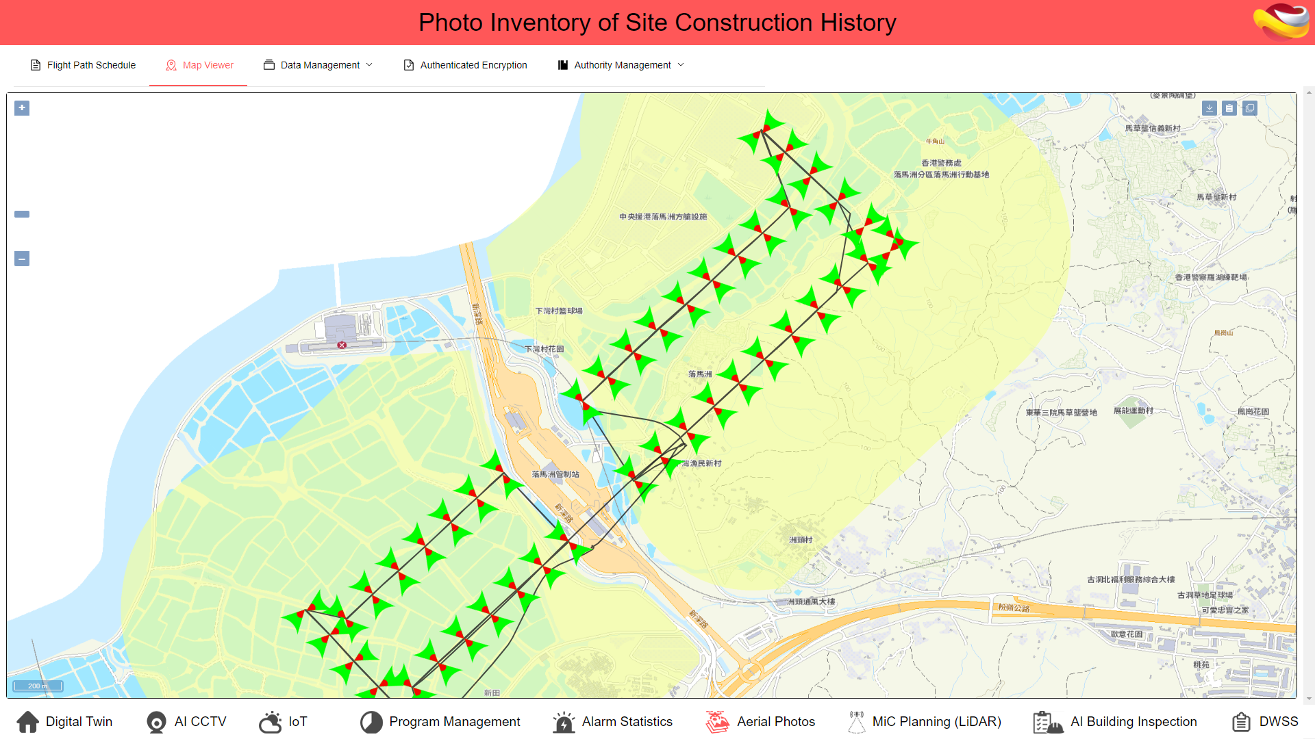
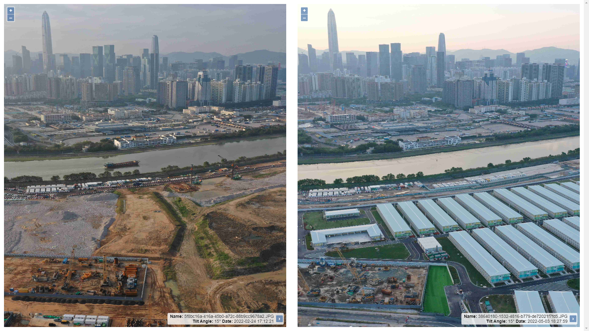
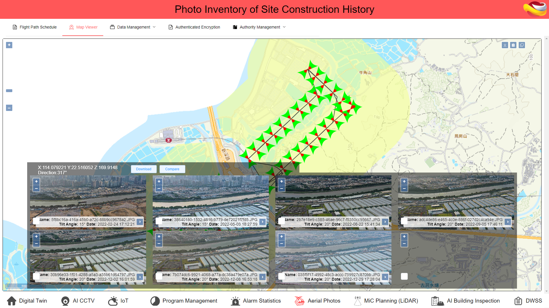
The Aerial Photos module revolutionizes site management by integrating advanced geotagging capabilities. Each drone-captured photo is embedded with precise geographic coordinates and directional data, ensuring accurate visual documentation of project sites. This geospatial intelligence allows managers to quickly pinpoint photo origins on a 2D map, enhancing spatial awareness and data-driven decision-making. Combined with synchronized time-based comparisons, it empowers teams to track changes over time, identify potential risks, and proactively address issues, making project oversight smarter and more responsive.
Secure Data Access and Collaborative Flexibility
With its robust encryption and granular permission controls, the Aerial Photos module ensures that sensitive aerial data remains protected. Only authorized personnel can access or download drone-captured images and videos, safeguarding project confidentiality. Additionally, the module offers convenient data download options, enabling teams to extract specific content for offline analysis, documentation, or external sharing. This balance between security and flexibility supports efficient collaboration across departments, external partners, and stakeholders, ensuring seamless communication without compromising data integrity or security.

Ambit Geospatial Solution and third parties collect personal information as specified in the privacy policy and use cookies or similar technologies for technical purposes and, with your consent, for experience, measurement and marketing (personalized ads) as specified in the cookie policy.
You can freely give, deny, or withdraw your consent at any time by accessing the preferences panel. Denying consent may make related features unavailable.
Use the “Accept” button to consent. Use the “Reject” button to continue without accepting.