Terrasolid is the industry standard software for point clouds and images processing developed specifically for the demanding requirements of geospatial, engineering operations and environmental professionals.
Point Clous Analysis
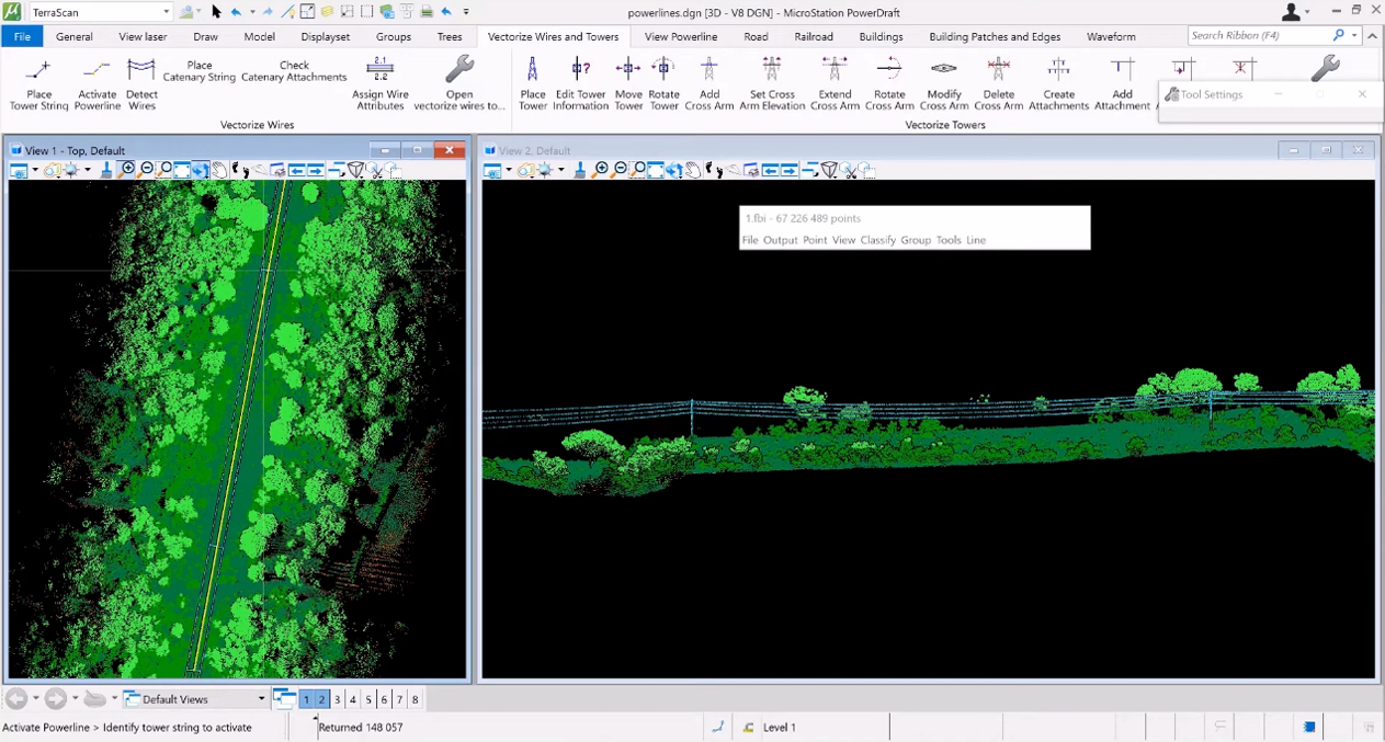
A complete power line analysis is achievable with Terrasolid software. Start with matching different flight lines, move to point cloud classification, which gives input for wires along with towers vectorization. This leads to clearance hazards identification. The vector data can be integrated into professional software and thus, used in performing thermal capacity studies, analysing rebuild/reconductor projects, and generating as-built records.
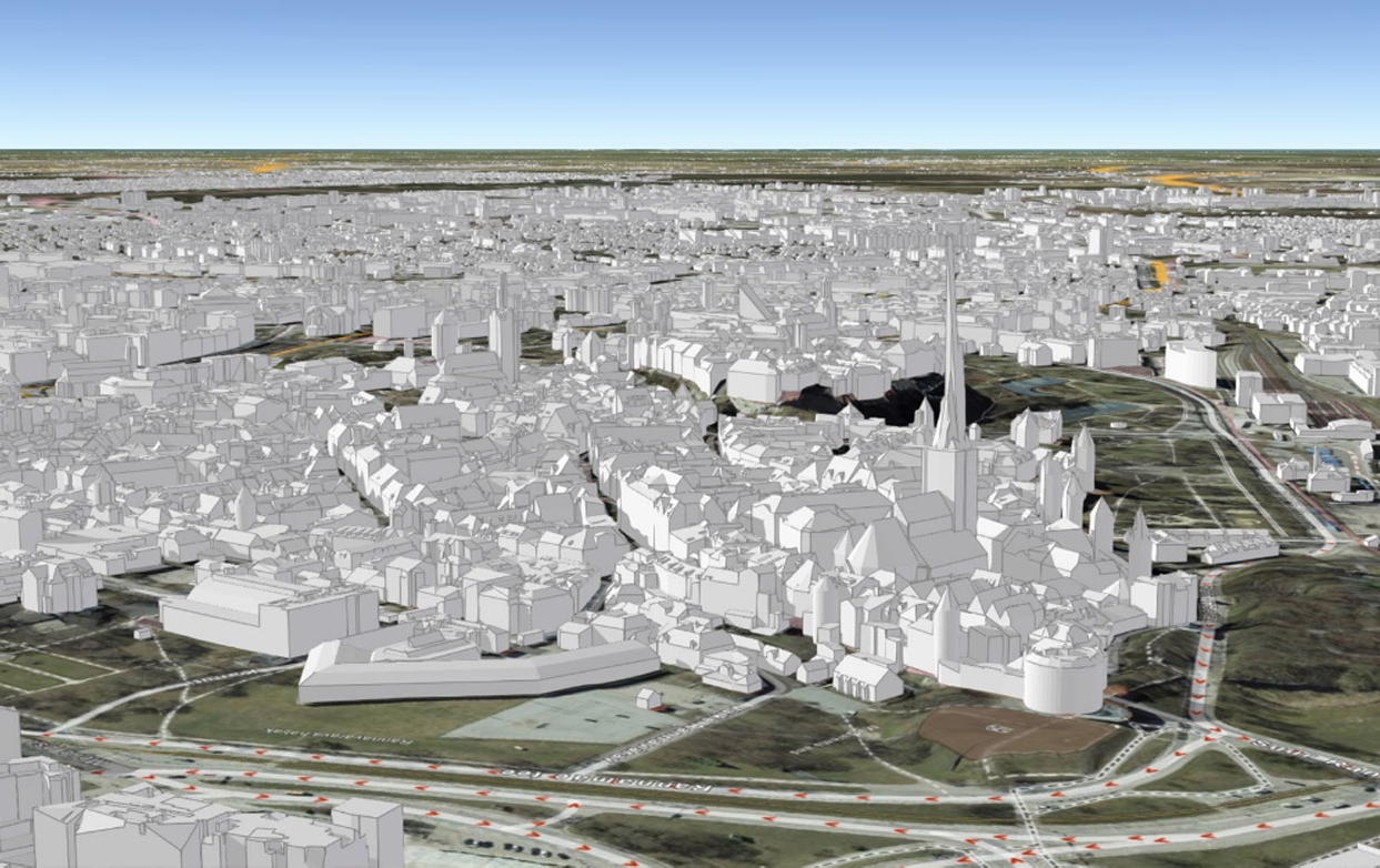
Detailed 3D Geospatial Data Production
Produce highly accurate 3D building and terrain models automatically from airborne laser data and images. Generate basic models from as low as 1 point/ m² or combine high density matched-to-each-other airborne and mobile data. With our software, you can create a complete city model including vectorized buildings, terrain and RGB color depicted objects.
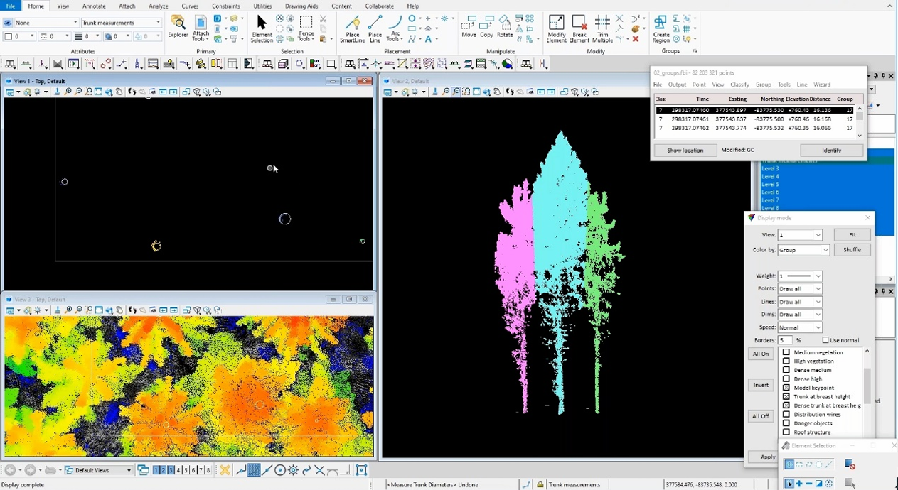
Forest Inventory Management
Monitor the growth and get tree inventory, including average height of trees, density of the canopy, amount of biomass, stand volume and the coverage of the vegetation, defining height, crown diameter, and species of individual trees, corridor analysis in Urban environments and park tree inventory analysis.