
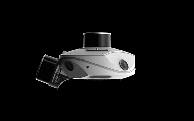
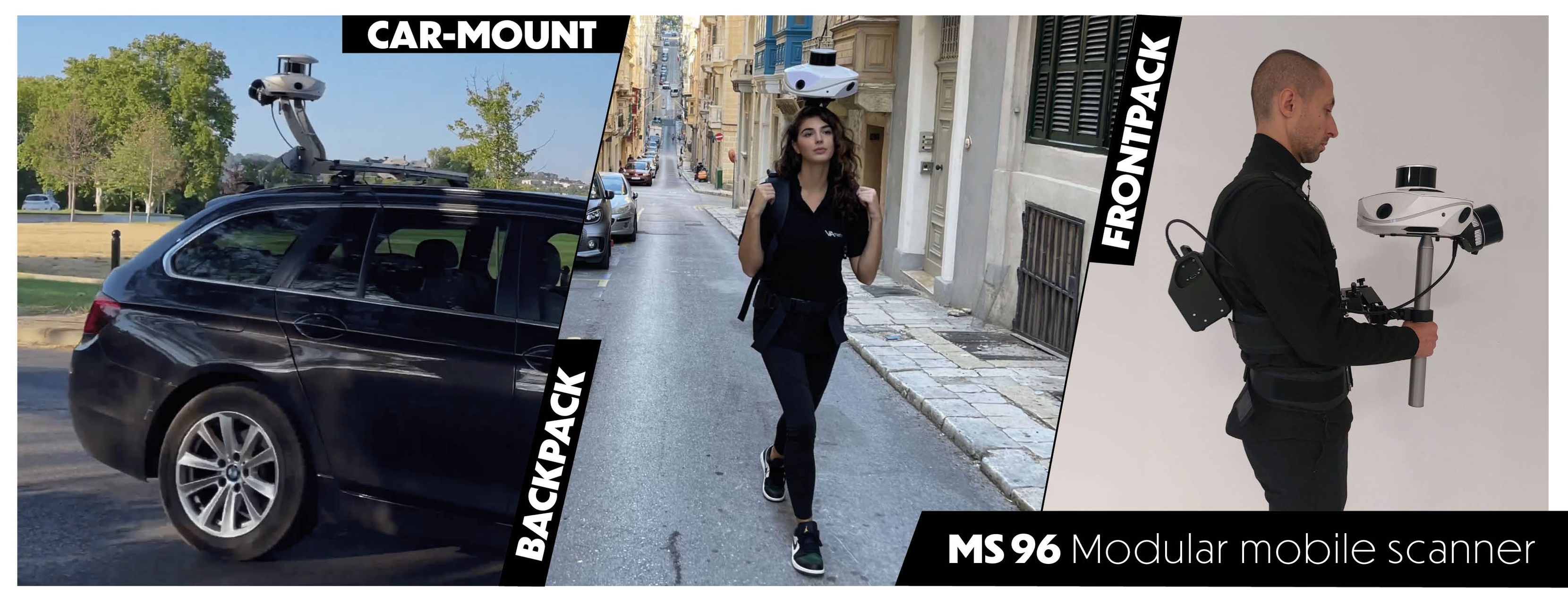
MS-96 is a unique solution combining SLAM algorithms, a high-end IMU and a GNSS receiver. It is designed to meet the diverse needs of measurement professionals. With remarkable modularity, it meets all the requirements and constraints of surveyors, topographers, architects, BIM modelers, and construction professionals. Versatile, it can be used indoors and outdoors, and adapts to all types of mobility: in backpack mode, in pedestrian version with its articulated arm, mounted on the roof of a vehicle, or even on a scooter. Its millimeter-noise Lidars combined with a proprietary 96 Mpx camera allows the generation of point clouds with exceptional precision and rendering, offering a complete and high-performing solution for the most demanding projects.
High Precision and Flexibility
The MS 96 Modular Mobile Scanner is designed for high-precision scanning with a 96 MP proprietary camera and modular sensor head. It features 1cm LiDAR precision and 5mm LiDAR accuracy, making it ideal for large-scale data capture in varying environments. Its GNSS compatibility allows for accurate positioning, ensuring reliable results in real-time operations.
Advanced Camera and LiDAR Technology
Equipped with four 24 MP cameras and advanced LiDAR technology, the MS 96 ensures detailed imaging and accurate distance measurements. The 20,000 lumens LED lighting system ensures effective data capture in low-light conditions. With its scan capacity of 320,000 points per second, this scanner is capable of delivering high-quality results at fast speeds.
Autonomous Operation and Portability
The MS 96 offers up to two hours of autonomous operation with dual lithium batteries. Its lightweight design (5.2kg) and portable configuration make it ideal for fieldwork, while the 1TB SSD ensures ample data storage. The scanner's system status stripe provides real-time feedback on its performance, enhancing the overall user experience.
Efficient Fieldwork Tool
The MS 96 Modular Mobile Scanner delivers precise scanning with 96 MP cameras and advanced LiDAR technology. It ensures fast, high-quality data capture with GNSS support. Portable and lightweight, it's ideal for fieldwork with up to two hours of battery life.